Phase Heritage is the specialist archaeological geophysical survey department of Phase SI. We have extensive experience of archaeological geophysical surveys and are market-leaders in high resolution multi-sensor magnetic surveys.
A planning constraint can be put on any development until the impact on any potential archaeology or cultural heritage remains has been determined. To ensure cost-effective mitigation it is crucial that information on the presence and extent of archaeological remains is known as early in the design and development process as is possible and informed geophysical surveys play a crucial role in this.
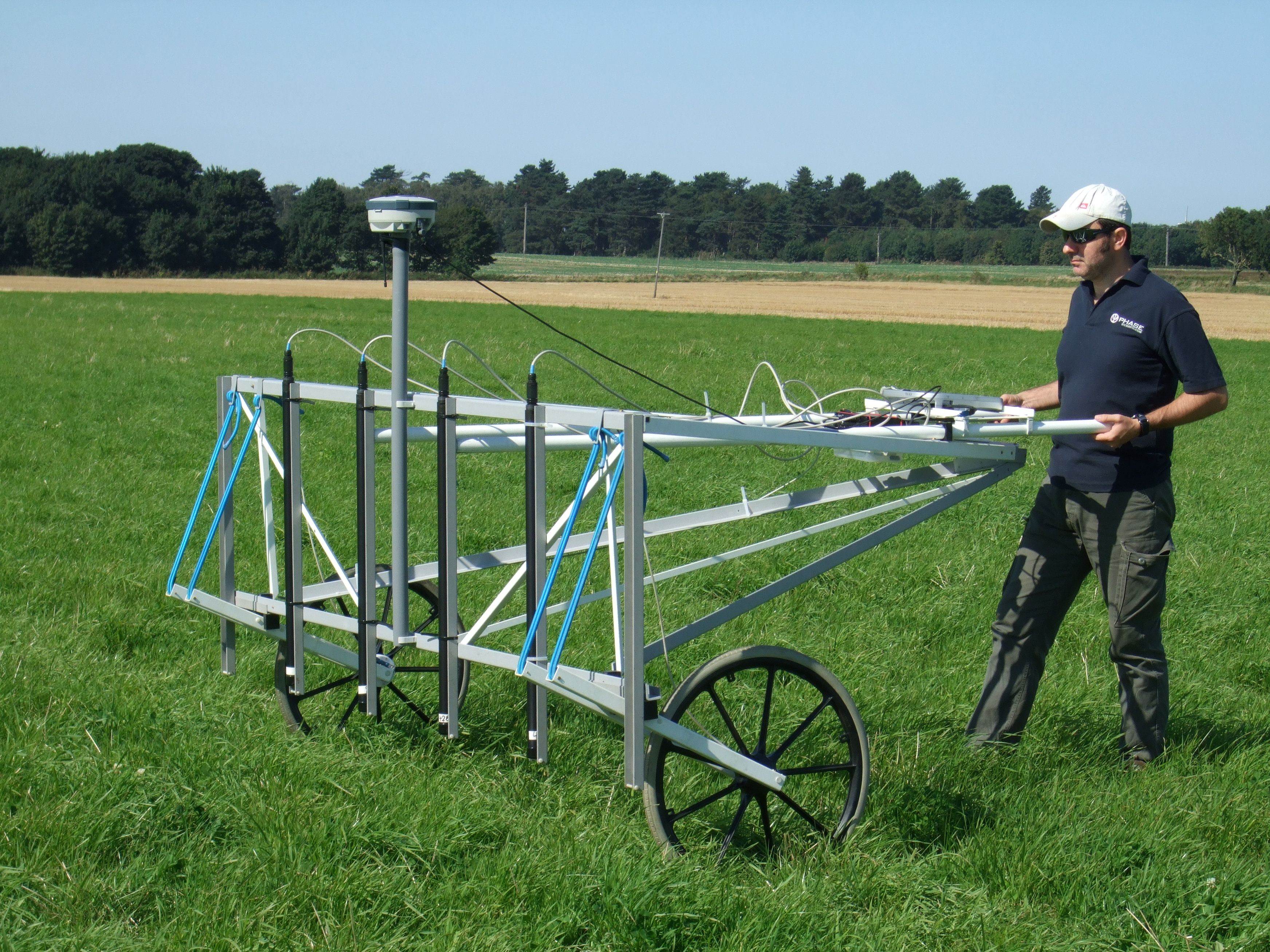
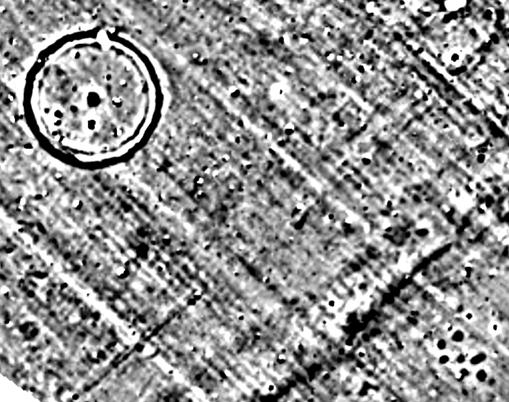
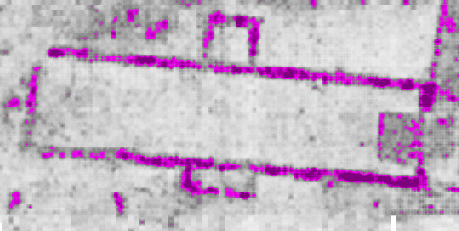
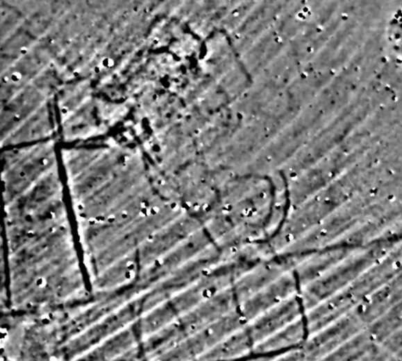
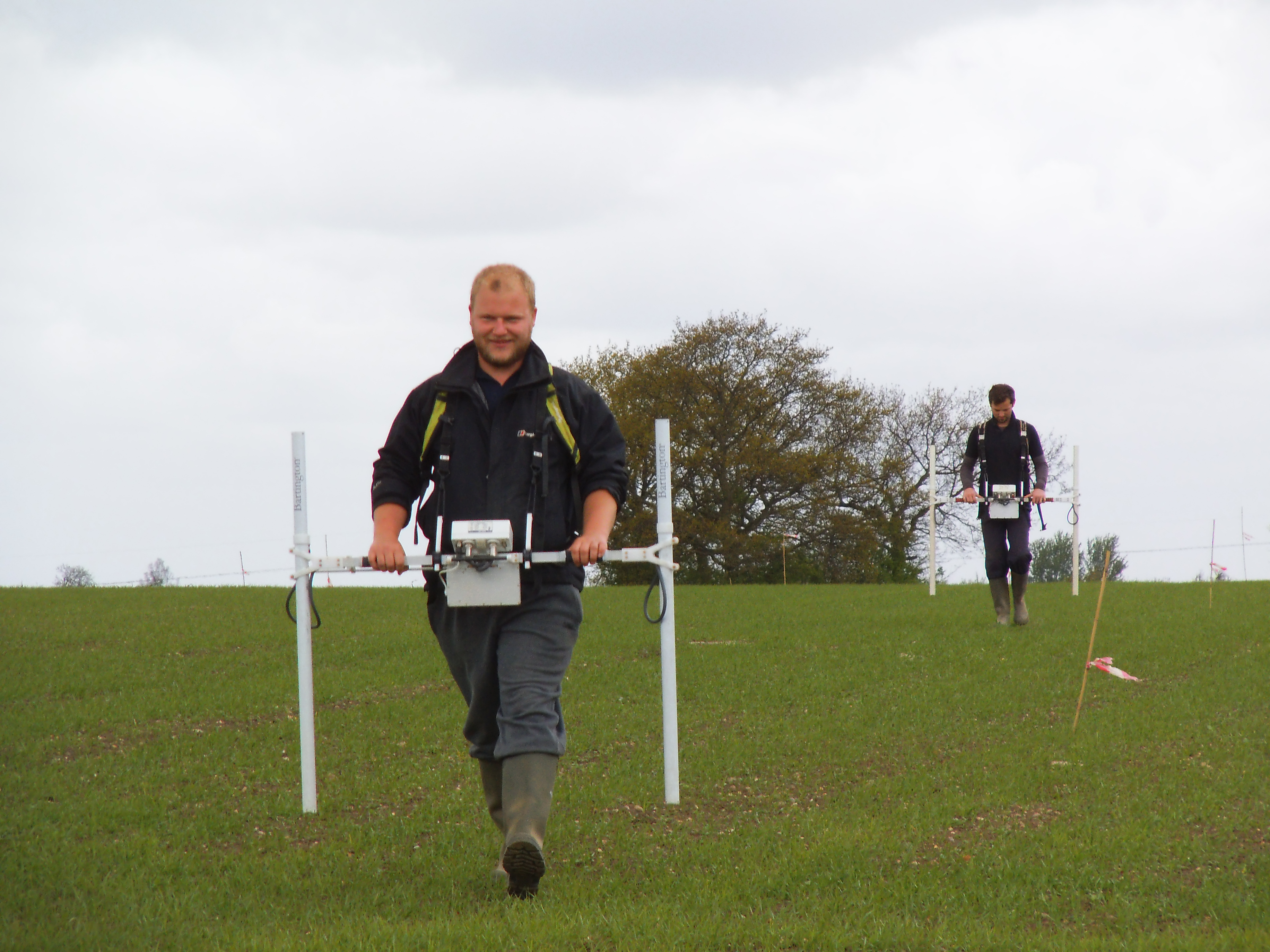
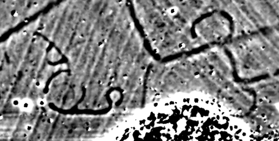
Our aim is to provide a high quality survey product and by putting the emphasis on data quality we are able to provide more reliable interpretations which can reduce the need, or better target, follow up intrusive work. Our high-resolution Multi-sensor Array Cart System (MACS) can collect 3 to 4 times as many data points as a traditional hand-held instrument with improved survey speeds and higher quality data. This improved quality is due to our investment in the latest and best technology coupled with our specialist experience but it does not come with an increased cost. The converse is true in that by utilising mulit-sensor systems we are able to reduce survey times for medium to large sites which can produce significant cost savings. We have the flexibility to hand or vehicle tow our carts and we always mobilise a hand-held instrument to site in case the ground conditions are not suitable for a cart.
Our hand towed cart systems can comfortably achieve coverage of up to 5 ha per day in reasonable site conditions and more if the site conditions are good. We can place in the field one system with 8 sensors at 0.5 m spacings and achieve this coverage or two carts, each with 4 sensors at 1 m intervals, with each cart covering up to 5 ha. When a cart can be vehicle towed we can achieve between 8 and 10 ha coverage with a single cart (in large regular fields). If greater detail is required we have the flexibility to adjust our sensor spacing to 0.25 m intervals and still achieve between 1.5 and 2 ha coverage a day. You tell us the resolution that is best-suited to your site and we can adapt our system to achieve it.
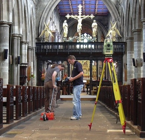
All of our heritage reporting and interpretations are carried out by staff who are qualified and experienced archaeological specialists, fieldwork is undertaken by dedicated, full-time geophysicists / surveyors and all archaeological surveys are managed by Mark Whittingham (MCIfA), who has over 20 years experience in the geophysical and heritage sectors. We are able to offer informed surveys carried out to the highest standards.
Phase Heritage only undertake non-intrusive surveys and so we are independent of the consultancy and excavation aspects of an archaeological assessment. This means that we can offer a truly unbiased survey and informed interpretation.
Phase Heritage can also assist in the procurement of archaeological excavations, desk-based assessments or watching briefs by working closely with specialist contractors.